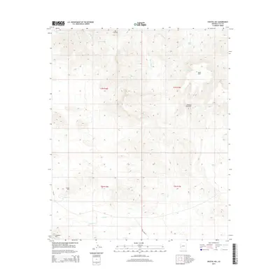
2014 Map of Crystal Hill
USGS Topo · Published 2014About this map
The Plomosa Mountains dominate this arid landscape in La Paz County, where a complex network of seasonal drainages defines the basin-and-range topography. This 2014 survey documents a region where water management and terrain markers are essential for navigation. Significant relief is provided by prominent landmarks like Black Mesa, Dos Picachos, and Crystal Hill. The lower elevations are etched with numerous drainages, including the Plomosita Wash, Italian Wash, and Apache Wash, which carry runoff during the desert's infrequent rains. Human activity is indicated by Jasper Spring Rd and vital water collection points such as Chalk Tank and Dripping Spring. The map provides a detailed look at the township and range boundaries that grid this portion of the Arizona desert, offering a clear view of the natural features in the Livingston Hills area.
Find a feature on this map
19 named features on this map. Tap any name to fly to it.
Don’t see what you’re looking for? This feature index may not catch every label — zoom into the map to look around manually.
Map Details
Editions of this 2014 Crystal Hill Map
This is the sole edition of this map. No revisions or reprints were ever made.
Other maps of this area

1942 · Blythe
USGS Topo · 1:250,000

1942 · Vicksburg
USGS Topo · 1:250,000

1954 · Salton Sea
USGS Topo · 1:250,000

1954 · Phoenix
USGS Topo · 1:250,000

1955 · Salton Sea
USGS Topo · 1:250,000

1957 · Phoenix
USGS Topo · 1:250,000

1958 · Phoenix
USGS Topo · 1:250,000

1959 · Salton Sea
USGS Topo · 1:250,000

1960 · Phoenix
USGS Topo · 1:250,000

1962 · Quartzsite
USGS Topo · 1:62,500