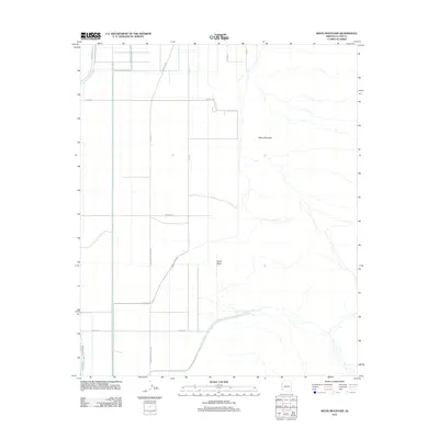
2011 Map of Moon Mountain
USGS Topo · Published 2011About this map
Moon Mountain dominates the eastern horizon of this La Paz County landscape, where the high desert terrain transitions into a structured network of rural roads and tribal routes. The arid geography is defined by the ephemeral Tyson Wash, which meanders through the central valley, and several drainage patterns that flow from the mountain's slopes. This 2011 survey illustrates a sparse but organized settlement pattern along the Ehrenberg Poston Hwy and various numbered avenues, reflecting the modern agricultural and residential layout of the Colorado River Indian Reservation. Local transit is facilitated by routes such as Indian Rte 25 and Indian Rte 28, while residential access is marked by family-named or local thoroughfares like Beeson Rd and Tsosie Rd. The grid system of Mohave Rd and its intersecting avenues contrasts with the natural, jagged contours of the mountain to the east.
Find a feature on this map
14 named features on this map. Tap any name to fly to it.
Don’t see what you’re looking for? This feature index may not catch every label — zoom into the map to look around manually.
Map Details
Editions of this 2011 Moon Mountain Map
This is the sole edition of this map. No revisions or reprints were ever made.
Other maps of this area

1931 · Moon Mtn
USGS Topo · 1:62,500

1932 · Moon Mtn
USGS Topo · 1:62,500

1933 · Cunningham Mtn
USGS Topo · 1:48,000

1940 · Dome Rock Mts
USGS Topo · 1:62,500

1942 · Blythe
USGS Topo · 1:250,000

1942 · MOON MTN
USGS Topo · 1:62,500

1945 · Big Maria Mtns
USGS Topo · 1:62,500

1951 · Big Maria Mts
USGS Topo · 1:62,500

1951 · Blythe NE
USGS Topo · 1:24,000

1954 · Salton Sea
USGS Topo · 1:250,000