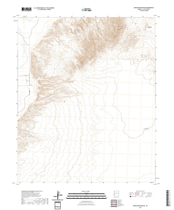
2021 Map of Moon Mountain NE
USGS Topo · Published 2021About this map
Mesquite Mtn rises as a prominent landmark in the northern portion of this Arizona desert landscape, overlooking the expansive La Posa Plain. This 2021 survey illustrates the intersection of several public land survey divisions, including t8n r20w and t7n r19w, highlighting how historical township and range lines continue to define administrative boundaries in La Paz County. The presence of Parker at the northeastern corner suggests the encroaching influence of local development, while E McCabe Rd represents one of the few established thoroughfares crossing the arid terrain. The map's detail provides a clear view of the natural topography where mountain foothills meet the broad, flat reaches of the desert floor, offering insight into the geographical constraints that have shaped local travel and land use.
Find a feature on this map
10 named features on this map. Tap any name to fly to it.
Don’t see what you’re looking for? This feature index may not catch every label — zoom into the map to look around manually.
Map Details
Editions of this 2021 Moon Mountain NE Map
This is the sole edition of this map. No revisions or reprints were ever made.
Other maps of this area

1911 · Parker
USGS Topo · 1:125,000

1930 · Linskey
USGS Topo · 1:62,500

1931 · Moon Mtn
USGS Topo · 1:62,500

1932 · Moon Mtn
USGS Topo · 1:62,500

1942 · Blythe
USGS Topo · 1:250,000

1942 · MOON MTN
USGS Topo · 1:62,500

1943 · Parker
USGS Topo · 1:62,500

1949 · Parker
USGS Topo · 1:62,500

1950 · Parker
USGS Topo · 1:62,500

1954 · Salton Sea
USGS Topo · 1:250,000