
1949 Map of Parker
USGS Topo · Published 1960About this map
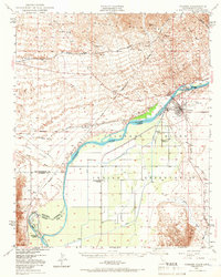
The Colorado River serves as the central artery for this late 1940s landscape, defining the jagged border between California and Arizona. The Colorado River Indian Reservation dominates the southern half of the sheet, revealing a developed network of irrigation ditches and canals that contrast sharply with the arid peaks of the Whipple Mountains to the north. Cultural sites within the reservation, such as the Mojave Indian Ch, the Cremation Ground, and the Colorado River Day Sch, provide specific geographic anchors for genealogical research.
Find a feature on this map
34 named features on this map. Tap any name to fly to it.
Don’t see what you’re looking for? This feature index may not catch every label — zoom into the map to look around manually.
Map Details
Editions of this 1949 Parker Map
2 editions found
Other maps of this area

1911 · Parker
USGS Topo · 1:125,000

1930 · Linskey
USGS Topo · 1:62,500

1931 · Moon Mtn
USGS Topo · 1:62,500

1932 · Moon Mtn
USGS Topo · 1:62,500

1942 · Blythe
USGS Topo · 1:250,000

1942 · MOON MTN
USGS Topo · 1:62,500

1943 · Giers Basin
USGS Topo · 1:62,500

1943 · Whipple Mts.
USGS Topo · 1:62,500

1943 · Parker
USGS Topo · 1:62,500

1943 · Vidal
USGS Topo · 1:62,500