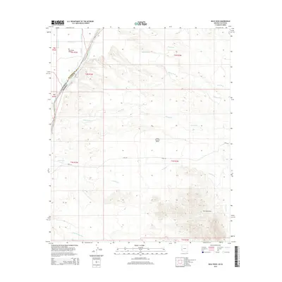
2014 Map of Mule Wash
USGS Topo · Published 2014About this map
The Colorado River forms the vital western boundary of this arid landscape, carving a fertile corridor between the Palo Verde Valley in California and the rugged Trigo Mountains in Arizona. This 2014 survey illustrates the sophisticated irrigation infrastructure supporting regional agriculture, including the D-23 Canal, D-23-1 Canal, and D 23 Spill. These man-made channels contrast with the natural ephemeral drainages that define the high desert floor, such as Mule Wash, Gould Wash, and the curiously named Crazy Woman Wash. While Levee Rd tracks the river’s edge, Cibola Rd strikes eastward across the Great Colorado Valley. The map documents a sparsely populated but highly managed borderland where the industrial water systems of the lowlands meet the primitive wilderness of the mountain peaks.
Find a feature on this map
24 named features on this map. Tap any name to fly to it.
Don’t see what you’re looking for? This feature index may not catch every label — zoom into the map to look around manually.
Map Details
Editions of this 2014 Mule Wash Map
This is the sole edition of this map. No revisions or reprints were ever made.
Other maps of this area

1933 · Cunningham Mtn
USGS Topo · 1:48,000

1934 · Trigo Peaks
USGS Topo · 1:48,000

1939 · Trigo Peaks
USGS Topo · 1:62,500

1940 · Dome Rock Mts
USGS Topo · 1:62,500

1942 · Blythe
USGS Topo · 1:250,000

1945 · Cibola
USGS Topo · 1:62,500

1951 · Blythe
USGS Topo · 1:24,000

1951 · Cibola
USGS Topo · 1:62,500

1952 · Mule Wash
USGS Topo · 1:24,000

1952 · Palo Verde
USGS Topo · 1:24,000