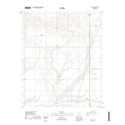
2018 Map of Red Hill NE
USGS Topo · Published 2018About this map
The Chocolate Mountains dominate the western portion of this 2018 survey, their landforms defined by steep relief and alluvial fans that spill into the desert basin. This landscape is a characteristic section of the Sonoran Desert in western Arizona, where drainage systems like Indian Wash cut through the terrain toward the south. The southern reaches of the map flatten into the Castle Dome Plain, a broad expanse that reflects the transition from mountainous uplift to the open desert floor. This region is marked by its jurisdictional divide, as the La Paz Co Yuma Co line runs north-to-south through the eastern side of the quadrangle. The lack of major human settlements highlights the region's preservation as a land of open washes and high ridges, providing a clear view of the natural topography along the county boundary.
Find a feature on this map
10 named features on this map. Tap any name to fly to it.
Don’t see what you’re looking for? This feature index may not catch every label — zoom into the map to look around manually.
Map Details
Editions of this 2018 Red Hill NE Map
This is the sole edition of this map. No revisions or reprints were ever made.
Other maps of this area

1934 · Trigo Peaks
USGS Topo · 1:48,000

1939 · Red Hill
USGS Topo · 1:62,500

1939 · Trigo Peaks
USGS Topo · 1:62,500

1942 · Blythe
USGS Topo · 1:250,000

1954 · Salton Sea
USGS Topo · 1:250,000

1954 · Red Hill
USGS Topo · 1:62,500

1954 · Trigo Peaks
USGS Topo · 1:62,500

1955 · Salton Sea
USGS Topo · 1:250,000

1959 · Salton Sea
USGS Topo · 1:250,000
1962 · Livingston Hills
USGS Topo · 1:62,500