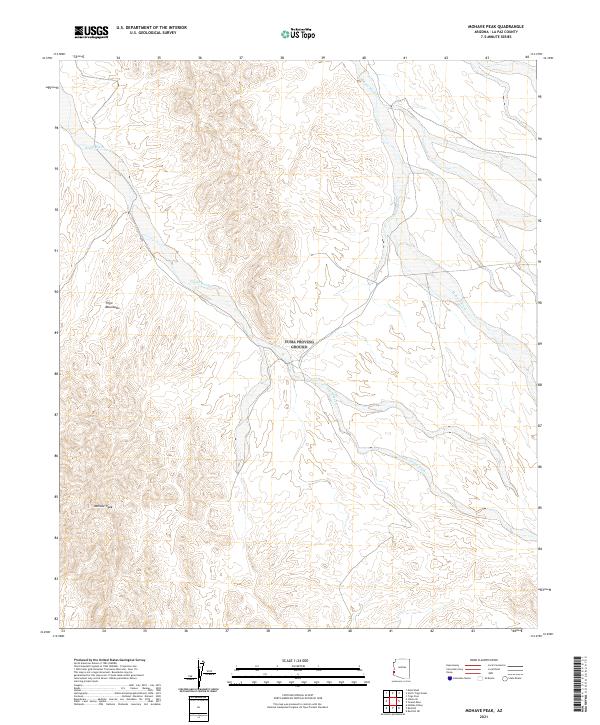
2021 Map of Mohave Peak
USGS Topo · Published 2021About this map
Mohave Peak stands as the primary landmark in this arid portion of La Paz County, anchored by the jagged profiles of the Trigo Mountains. The landscape is defined by its drainage patterns, most notably the wide, braided courses of Mohave Wash and Gould Wash that cut through the desert floor. This 2021 survey by the U.S. Geological Survey details a region largely shaped by its natural topography rather than human settlement. The absence of modern development highlights the preserved state of the land, providing a clear record of the area's physical geography and historical land boundaries within the Public Land Survey System as they exist in the early 21st century.
Find a feature on this map
8 named features on this map. Tap any name to fly to it.
Don’t see what you’re looking for? This feature index may not catch every label — zoom into the map to look around manually.
Map Details
Editions of this 2021 Mohave Peak Map
This is the sole edition of this map. No revisions or reprints were ever made.
Other maps of this area

1934 · Trigo Peaks
USGS Topo · 1:48,000

1939 · Red Hill
USGS Topo · 1:62,500

1939 · Trigo Peaks
USGS Topo · 1:62,500

1942 · Blythe
USGS Topo · 1:250,000

1945 · Cibola
USGS Topo · 1:62,500

1945 · Picacho
USGS Topo · 1:62,500

1951 · Picacho
USGS Topo · 1:62,500

1951 · Cibola
USGS Topo · 1:62,500

1952 · Mule Wash
USGS Topo · 1:24,000

1954 · Salton Sea
USGS Topo · 1:250,000