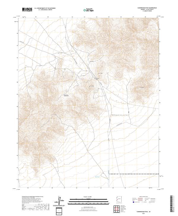
2021 Map of Cunningham Pass
USGS Topo · Published 2021About this map
Cunningham Pass cuts through the high ridges of the Harcuvar Mountains in this western Arizona landscape. The pass serves as a central transit point, where Alamo Rd winds through the varied elevations of the range, passing between Ecc Peak and W C P Peak. To the south, the terrain descends toward the Winchester Reservoir, a rare water feature in this arid environment. The map details a desert region defined by its topography rather than urban centers, showing a network of utility and service tracks like Powerline Rd and Low Mountain Rd. These routes provide access to the foothills of Low Mtn and the surrounding basin, reflecting the area's continued use for resource management and regional travel through the rugged interior of La Paz County.
Find a feature on this map
16 named features on this map. Tap any name to fly to it.
Don’t see what you’re looking for? This feature index may not catch every label — zoom into the map to look around manually.
Map Details
Editions of this 2021 Cunningham Pass Map
This is the sole edition of this map. No revisions or reprints were ever made.
Other maps of this area

1923 · Signal
USGS Topo · 1:250,000

1942 · Signal
USGS Topo · 1:250,000

1942 · Vicksburg
USGS Topo · 1:250,000

1950 · Prescott
USGS Topo · 1:250,000

1954 · Prescott
USGS Topo · 1:250,000

1954 · Phoenix
USGS Topo · 1:250,000

1957 · Phoenix
USGS Topo · 1:250,000

1958 · Prescott
USGS Topo · 1:250,000

1958 · Phoenix
USGS Topo · 1:250,000

1959 · Prescott
USGS Topo · 1:250,000