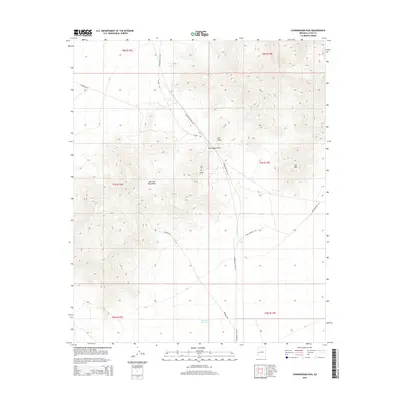
2014 Map of Cunningham Pass
USGS Topo · Published 2014About this map
The Harcuvar Mountains dominate this 2014 study of the high desert of La Paz County, where the topography is defined by sharp elevation shifts and isolated summits. The namesake Cunningham Pass serves as a critical point of movement through the range, flanked by prominent features such as ECC Peak, W C P Peak, and the more distant Low Mtn. A network of unpaved routes, including Cunningham Pass Rd and Alamo Rd, trace the natural contours of the land, illustrating how modern travel often still follows the most accessible geological gaps.
Find a feature on this map
17 named features on this map. Tap any name to fly to it.
Don’t see what you’re looking for? This feature index may not catch every label — zoom into the map to look around manually.
Map Details
Editions of this 2014 Cunningham Pass Map
This is the sole edition of this map. No revisions or reprints were ever made.
Other maps of this area

1923 · Signal
USGS Topo · 1:250,000

1942 · Signal
USGS Topo · 1:250,000

1942 · Vicksburg
USGS Topo · 1:250,000

1950 · Prescott
USGS Topo · 1:250,000

1954 · Prescott
USGS Topo · 1:250,000

1954 · Phoenix
USGS Topo · 1:250,000

1957 · Phoenix
USGS Topo · 1:250,000

1958 · Prescott
USGS Topo · 1:250,000

1958 · Phoenix
USGS Topo · 1:250,000

1959 · Prescott
USGS Topo · 1:250,000