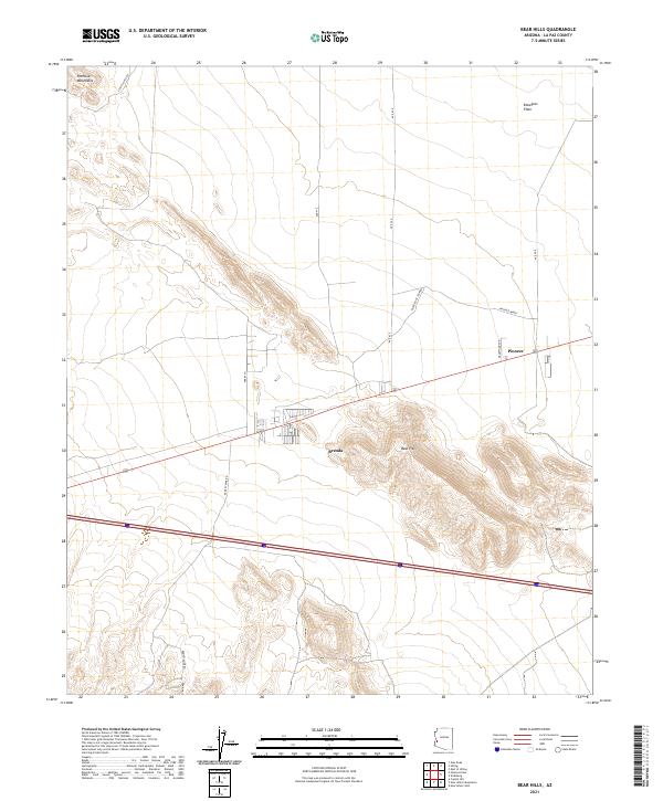
2021 Map of Bear Hills
USGS Topo · Published 2021About this map
The arid expanse of Ranegras Plain stretches across this western Arizona landscape, framed by the sharp rises of the Plomosa Mountains and the distinct volcanic forms of the Bear Hills. This region, documented by the U.S. Geological Survey in 2021, centers on the small roadside settlements of Brenda and Pioneer, which serve as vital hubs in an otherwise sparse desert environment. The mapping reveals a transition from traditional desert travel routes to modern infrastructure, where historical traces like Stage Coach Rd and names like Ramsey Mine Rd hint at the area's mining and transit history. The local road network, including Black Rock Tank Rd and Deadwood Ave, provides a clear view of how development has clustered around the highway corridor while maintaining its connection to the surrounding wilderness and the large-scale township grids of the Public Land Survey System.
Find a feature on this map
20 named features on this map. Tap any name to fly to it.
Don’t see what you’re looking for? This feature index may not catch every label — zoom into the map to look around manually.
Map Details
Editions of this 2021 Bear Hills Map
This is the sole edition of this map. No revisions or reprints were ever made.
Other maps of this area

1930 · Linskey
USGS Topo · 1:62,500

1942 · Blythe
USGS Topo · 1:250,000

1942 · Vicksburg
USGS Topo · 1:250,000

1954 · Salton Sea
USGS Topo · 1:250,000

1954 · Phoenix
USGS Topo · 1:250,000

1955 · Salton Sea
USGS Topo · 1:250,000

1957 · Phoenix
USGS Topo · 1:250,000

1958 · Phoenix
USGS Topo · 1:250,000

1959 · Salton Sea
USGS Topo · 1:250,000

1960 · Phoenix
USGS Topo · 1:250,000