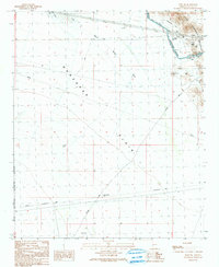
1990 Map of Hope SW
USGS Topo · Published 1990About this map
The Ran Egras Plain dominates this arid landscape, a broad expanse of desert terrain defined by water management and transit infrastructure. The Hayden-Rhodes Aqueduct cuts through the northeastern sector, supported by associated sewage disposal ponds, a water tank, and multiple sections of Road on Levee. These features illustrate the intensive engineering required to move water through the desert. To the south, the northern boundary of the Kofa National Wildlife Refuge marks a transition into protected lands, where check dams are visible in the drainage channels.
Find a feature on this map
25 named features on this map. Tap any name to fly to it.
Don’t see what you’re looking for? This feature index may not catch every label — zoom into the map to look around manually.
Map Details
Editions of this 1990 Hope SW Map
This is the sole edition of this map. No revisions or reprints were ever made.
Other maps of this area

1942 · Vicksburg
USGS Topo · 1:250,000

1954 · Phoenix
USGS Topo · 1:250,000

1957 · Phoenix
USGS Topo · 1:250,000

1958 · Phoenix
USGS Topo · 1:250,000

1960 · Phoenix
USGS Topo · 1:250,000

1961 · Hope
USGS Topo · 1:62,500

1962 · Little Horn Mts
USGS Topo · 1:62,500

1962 · Kofa Butte
USGS Topo · 1:62,500

1962 · Vicksburg
USGS Topo · 1:62,500

1969 · Phoenix
USGS Topo · 1:250,000