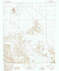
1990 Map of Coyote Peak
USGS Topo · Published 1990About this map
The Little Horn Mountains dominate this arid landscape on the border of La Paz and Yuma Counties. This 1990 provisional survey documents a transition zone where the Ranegras Plain meets the high peaks of the Kofa National Wildlife Refuge. The map captures a quiet interior of the Sonoran Desert, defined by seasonal water management and rugged landforms. Scattered prospects and a Mine Shaft indicate a history of mineral exploration, while several Check Dams and the Vinegaroon Well highlight the infrastructure required for life and livestock in this environment. Significant landmarks like Coyote Peak, the Royal Arch, and Natural Arch serve as permanent beacons across the vast terrain. Modern access is represented by Hovatter Road and various 4WD trails that navigate the washes, including Cementosa Wash.
Find a feature on this map
16 named features on this map. Tap any name to fly to it.
Don’t see what you’re looking for? This feature index may not catch every label — zoom into the map to look around manually.
Map Details
Editions of this 1990 Coyote Peak Map
This is the sole edition of this map. No revisions or reprints were ever made.
Other maps of this area

1942 · Vicksburg
USGS Topo · 1:250,000

1954 · Phoenix
USGS Topo · 1:250,000

1957 · Phoenix
USGS Topo · 1:250,000

1958 · Phoenix
USGS Topo · 1:250,000

1960 · Phoenix
USGS Topo · 1:250,000

1961 · Hope
USGS Topo · 1:62,500

1962 · Little Horn Mts
USGS Topo · 1:62,500

1962 · Kofa Butte
USGS Topo · 1:62,500

1962 · Vicksburg
USGS Topo · 1:62,500

1969 · Phoenix
USGS Topo · 1:250,000