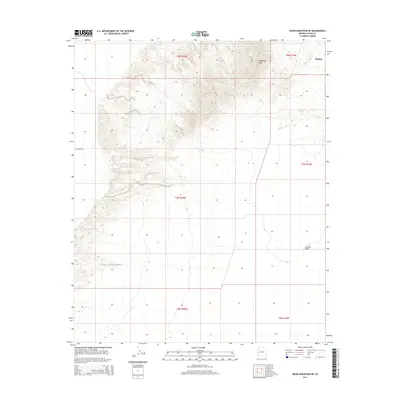
2014 Map of Moon Mountain NE
USGS Topo · Published 2014About this map
Parker sits at the northeastern edge of this desert landscape, serving as a primary point of reference for the surrounding arid terrain. The map is defined by the significant elevation of Mesquite Mtn in the north-central region, which gives way to the broad expanse of the La Posa Plain as the topography flattens toward the south and east. Land use in this corner of Arizona is heavily structured by the Public Land Survey System, with the clear gridded townships of t8n r20w, t7n r19w, and others providing a formal framework over the natural geography. Transportation is sparse, primarily represented by E Mccabe Rd, which cuts westward through the lower foothills. This 2014 survey documents the area's characteristic transition from high desert peaks to the open alluvial plains common to the Lower Colorado River Valley region.
Find a feature on this map
10 named features on this map. Tap any name to fly to it.
Don’t see what you’re looking for? This feature index may not catch every label — zoom into the map to look around manually.
Map Details
Editions of this 2014 Moon Mountain NE Map
This is the sole edition of this map. No revisions or reprints were ever made.
Other maps of this area

1911 · Parker
USGS Topo · 1:125,000

1930 · Linskey
USGS Topo · 1:62,500

1931 · Moon Mtn
USGS Topo · 1:62,500

1932 · Moon Mtn
USGS Topo · 1:62,500

1942 · Blythe
USGS Topo · 1:250,000

1942 · MOON MTN
USGS Topo · 1:62,500

1943 · Parker
USGS Topo · 1:62,500

1949 · Parker
USGS Topo · 1:62,500

1950 · Parker
USGS Topo · 1:62,500

1954 · Salton Sea
USGS Topo · 1:250,000