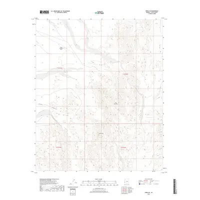
2018 Map of Cibola SE
USGS Topo · Published 2018About this map
Trigo Mountains terrain dominates this corner of the desert landscape, where steep contours define the local topography near Needles Eye. To the west, the land transitions into the Great Colorado Valley, a broad expanse that stands in contrast to the high ridges of the interior. The drainage network is characterized by several named desert washes, including Crazy Woman Wash and Mule Wash, which reveal the pathways of seasonal runoff through the arid environment. Human access is limited to a few specific corridors such as Hart Mine Rd and Island Unit Rd, reflecting the remote nature of this portion of La Paz County. The presence of Hart-Mine Wash suggests historical connections to mining activity that once shaped the navigation of these canyons.
Find a feature on this map
12 named features on this map. Tap any name to fly to it.
Don’t see what you’re looking for? This feature index may not catch every label — zoom into the map to look around manually.
Map Details
Editions of this 2018 Cibola SE Map
This is the sole edition of this map. No revisions or reprints were ever made.
Other maps of this area

1934 · Trigo Peaks
USGS Topo · 1:48,000

1939 · Red Hill
USGS Topo · 1:62,500

1939 · Trigo Peaks
USGS Topo · 1:62,500

1942 · Blythe
USGS Topo · 1:250,000

1945 · Cibola
USGS Topo · 1:62,500

1945 · Picacho
USGS Topo · 1:62,500

1951 · Picacho
USGS Topo · 1:62,500

1951 · Cibola
USGS Topo · 1:62,500

1952 · Mule Wash
USGS Topo · 1:24,000

1952 · Palo Verde
USGS Topo · 1:24,000