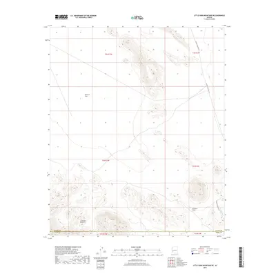
2018 Map of Little Horn Mountains NE
USGS Topo · Published 2018About this map
The Little Horn Mountains dominate the southwestern and central portions of this desert landscape, where high ridgelines rise sharply above the floor of the Ranegras Plain. This arid region in western Arizona is defined by dramatic elevation changes between the jagged peaks and the wide, open basin to the north. Movement through the area follows the natural contours of the land, with drainage features like Deadman Wash carving paths toward the Nottbusch Valley in the southeast. A single primary artery, Palomas Harquahala Rd, provides the main transit route across the eastern edge of the quadrangle. The map also delineates the administrative boundary between La Paz and Yuma counties, marking a modern political divide in a territory that remains largely defined by its natural topography.
Find a feature on this map
12 named features on this map. Tap any name to fly to it.
Don’t see what you’re looking for? This feature index may not catch every label — zoom into the map to look around manually.
Map Details
Editions of this 2018 Little Horn Mountains NE Map
This is the sole edition of this map. No revisions or reprints were ever made.
Other maps of this area

1942 · Vicksburg
USGS Topo · 1:250,000

1954 · Phoenix
USGS Topo · 1:250,000

1957 · Phoenix
USGS Topo · 1:250,000

1958 · Phoenix
USGS Topo · 1:250,000

1960 · Phoenix
USGS Topo · 1:250,000

1961 · Hope
USGS Topo · 1:62,500

1961 · Lone Mountain
USGS Topo · 1:62,500

1962 · Little Horn Mts
USGS Topo · 1:62,500

1962 · Eagletail Mts
USGS Topo · 1:62,500

1969 · Phoenix
USGS Topo · 1:250,000