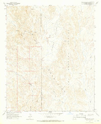
1965 Map of Hidden Valley
USGS Topo · Published 1966About this map
Trigo Mountains terrain dominates this mid-1960s survey, illustrating a landscape defined by desert drainage systems and mining history. The western portion of the map is marked by an extensive network of jeep trails that navigate between Lopez Wash and Clip Wash, providing access to isolated industrial sites such as the Black Diamond Mine and the Clip Mine.
Find a feature on this map
15 named features on this map. Tap any name to fly to it.
Don’t see what you’re looking for? This feature index may not catch every label — zoom into the map to look around manually.
Map Details
Editions of this 1965 Hidden Valley Map
2 editions found
Other maps of this area

1934 · Trigo Peaks
USGS Topo · 1:48,000

1939 · Red Hill
USGS Topo · 1:62,500

1939 · Trigo Peaks
USGS Topo · 1:62,500

1942 · Blythe
USGS Topo · 1:250,000

1945 · Cibola
USGS Topo · 1:62,500

1945 · Picacho
USGS Topo · 1:62,500

1951 · Picacho
USGS Topo · 1:62,500

1951 · Cibola
USGS Topo · 1:62,500

1954 · Salton Sea
USGS Topo · 1:250,000

1954 · Red Hill
USGS Topo · 1:62,500