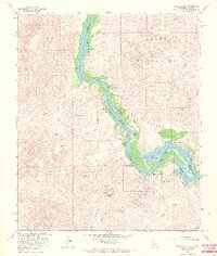
1965 Map of Picacho SW
USGS Topo · Published 1966About this map
The Colorado River winds through the borderlands of Imperial Co and Yuma Co in this mid-1960s study of the desert riverfront. The landscape is defined by the contrast between the fertile river corridor of the Imperial National Wildlife Refuge and the arid, broken terrain of the Trigo Mountains. Notable historical sites are recorded along the banks, including Nortons Landing (Site), Hoge Ranch (Site), and Nommel Place (Site), indicating earlier settlement patterns before the area was primarily designated for conservation and recreation.
Find a feature on this map
34 named features on this map. Tap any name to fly to it.
Don’t see what you’re looking for? This feature index may not catch every label — zoom into the map to look around manually.
Map Details
Editions of this 1965 Picacho SW Map
3 editions found
Other maps of this area

1903 · Yuma
USGS Topo · 1:125,000

1905 · Yuma
USGS Topo · 1:125,000

1942 · Yuma
USGS Topo · 1:250,000

1942 · Blythe
USGS Topo · 1:250,000

1945 · Picacho Peak
USGS Topo · 1:62,500

1945 · Picacho
USGS Topo · 1:62,500

1951 · Picacho
USGS Topo · 1:62,500

1951 · Picacho Peak
USGS Topo · 1:62,500

1953 · Quartz Peak
USGS Topo · 1:62,500

1953 · Ogilby
USGS Topo · 1:62,500