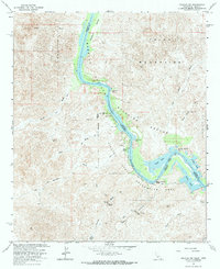
1965 Map of Picacho SW
USGS Topo · Published 1973About this map
The Colorado River carves a green corridor through the arid borderlands of California and Arizona in this mid-1960s survey. This specific stretch is defined by the Imperial National Wildlife Refuge and Picacho State Recreation Area, where the river's slow movement supports a network of backwater features like Adobe Lake, Nortons Lake, and Regan Slough. Unlike the open water of the main channel, these quiet basins reflect the complex hydrology of the lower Colorado.
Find a feature on this map
32 named features on this map. Tap any name to fly to it.
Don’t see what you’re looking for? This feature index may not catch every label — zoom into the map to look around manually.
Map Details
Editions of this 1965 Picacho SW Map
3 editions found
Other maps of this area

1903 · Yuma
USGS Topo · 1:125,000

1905 · Yuma
USGS Topo · 1:125,000

1942 · Yuma
USGS Topo · 1:250,000

1942 · Blythe
USGS Topo · 1:250,000

1945 · Picacho Peak
USGS Topo · 1:62,500

1945 · Picacho
USGS Topo · 1:62,500

1951 · Picacho
USGS Topo · 1:62,500

1951 · Picacho Peak
USGS Topo · 1:62,500

1953 · Quartz Peak
USGS Topo · 1:62,500

1953 · Ogilby
USGS Topo · 1:62,500