
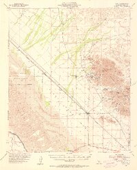
1953 Map of Ogilby
USGS Topo · Published 1954About this map
The Cargo Muchacho Mountains dominate the eastern portion of this desert landscape, revealing a dense concentration of historical mining activity in the mid-20th century. Numerous named prospects and shafts, including the American Girl Mine and La Colorada Mine, are clustered around the settlement of Tumco and the nearby Hedges (Site). This area provides a look at the hard-rock mining infrastructure of Imperial County, complete with the Hedges Cem and various unnamed cemeteries near the tracks.
Find a feature on this map
32 named features on this map. Tap any name to fly to it.
Don’t see what you’re looking for? This feature index may not catch every label — zoom into the map to look around manually.
Map Details
Editions of this 1953 Ogilby Map
2 editions found
Other maps of this area

1903 · Yuma
USGS Topo · 1:125,000

1905 · Yuma
USGS Topo · 1:125,000

1907 · Holtville
USGS Topo · 1:125,000

1940 · Yuma
USGS Topo · 1:62,500

1942 · El Centro
USGS Topo · 1:250,000

1942 · Yuma
USGS Topo · 1:250,000

1942 · Blythe
USGS Topo · 1:250,000

1945 · Picacho Peak
USGS Topo · 1:62,500

1945 · Picacho
USGS Topo · 1:62,500

1945 · Yuma
USGS Topo · 1:62,500