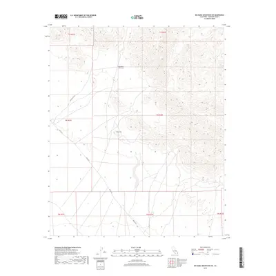
2018 Map of Big Maria Mountains SW
USGS Topo · Published 2018About this map
Big Maria Mountains dominate the eastern landscape of this Riverside County region, showcasing a complex network of arid ridges and deep desert washes. The terrain transitions from the steep slopes of the mountains to the more level desert floor in the west, where Black Hill stands as a prominent solitary landmark. This 2018 survey captures the critical infrastructure that traverses this remote stretch of the Colorado Desert, specifically Midland Rd and Arlington Mine Rd. These corridors follow the natural topography of the basin, reflecting the historical routes used to access the mining districts and geological resources of the interior desert ranges. The map provides a clear look at the township and range survey lines that divide this expansive public land, offering a modern perspective on a landscape defined by its severe elevation changes and isolated peaks.
Find a feature on this map
11 named features on this map. Tap any name to fly to it.
Don’t see what you’re looking for? This feature index may not catch every label — zoom into the map to look around manually.
Map Details
Editions of this 2018 Big Maria Mountains SW Map
This is the sole edition of this map. No revisions or reprints were ever made.
Other maps of this area

1942 · Blythe
USGS Topo · 1:250,000

1945 · Big Maria Mtns
USGS Topo · 1:62,500

1945 · Midland
USGS Topo · 1:62,500

1951 · Big Maria Mts
USGS Topo · 1:62,500

1951 · McCoy Wash
USGS Topo · 1:24,000

1951 · Blythe NE
USGS Topo · 1:24,000

1952 · Midland
USGS Topo · 1:62,500

1952 · Mc Coy Spring
USGS Topo · 1:62,500

1954 · Salton Sea
USGS Topo · 1:250,000
1954 · Big Maria Mts. NE
USGS Topo · 1:24,000