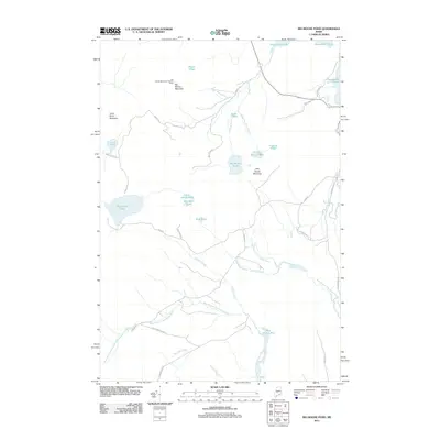
2011 Map of Big Moose Pond
USGS Topo · Published 2011About this map
Big Moose Mountain and its Lookout Tower dominate the northern terrain of this Piscataquis County landscape. The area is defined by a dense network of high-elevation water bodies and drainage systems, including Big Indian Pond, Big Moose Pond, and Trout Pond. This 2011 survey details the convergence of several major waterways, most notably the East Branch and West Branch Piscataquis River, which snake through the southern half of the quadrangle. A legacy of transportation and resource management is visible through labels such as the Railroad Bed Rd along the eastern edge and the Intake Pond near Little Moose Brook. Smaller basins like Little Notch Pond and Big Notch Pond sit tucked between the peaks, illustrating the complex glacial topography of the North Woods.
Find a feature on this map
37 named features on this map. Tap any name to fly to it.
Don’t see what you’re looking for? This feature index may not catch every label — zoom into the map to look around manually.
Map Details
Editions of this 2011 Big Moose Pond Map
This is the sole edition of this map. No revisions or reprints were ever made.
Other maps of this area

1905 · The Forks
USGS Topo · 1:62,500

1907 · The Forks
USGS Topo · 1:62,500

1920 · Moosehead Lake
USGS Topo · 1:62,500

1921 · Brassua Lake
USGS Topo · 1:62,500

1922 · Moosehead Lake
USGS Topo · 1:62,500

1923 · Brassua Lake
USGS Topo · 1:62,500

1930 · Moosehead Lake
USGS Topo · 1:62,500

1944 · Brassua Lake
USGS Topo · 1:62,500

1944 · Moosehead Lake
USGS Topo · 1:62,500

1951 · Greenville
USGS Topo · 1:62,500
Featured Places
- Shirley, ME
- East Moxie Township, ME
- Cove Point Township, ME
- Moosehead Junction Township, ME
- Harfords Point Township, ME