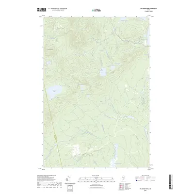
2023 Map of Big Moose Pond
USGS Topo · Published 2023About this map
The high peaks of Big Moose Mtn and Trout Pond Mtn dominate this Piscataquis County landscape, where the headwaters of the Piscataquis River system begin their descent. This interior region is defined by a dense network of mountain ponds and wetlands, including Big Moose Pond, Papoose Pond, and the wide reaches of West Shirley Bog to the south. The drainage patterns are clearly visible as Gulliver Brook and Mud Pond Brook feed into the East Branch Piscataquis River, while the West Branch Piscataquis River flows along the western slopes of Little Moose Mtn. The presence of the B & A Railroad Rd N on the eastern edge and the boundary line between Somerset Co and Piscataquis Co highlight the logistical and political divisions in this heavily forested timberland area, while primitive routes like Dyer Rd and White Rd provide limited access to the water bodies.
Find a feature on this map
35 named features on this map. Tap any name to fly to it.
Don’t see what you’re looking for? This feature index may not catch every label — zoom into the map to look around manually.
Map Details
Editions of this 2023 Big Moose Pond Map
This is the sole edition of this map. No revisions or reprints were ever made.
Other maps of this area

1905 · The Forks
USGS Topo · 1:62,500

1907 · The Forks
USGS Topo · 1:62,500

1920 · Moosehead Lake
USGS Topo · 1:62,500

1921 · Brassua Lake
USGS Topo · 1:62,500

1922 · Moosehead Lake
USGS Topo · 1:62,500

1923 · Brassua Lake
USGS Topo · 1:62,500

1930 · Moosehead Lake
USGS Topo · 1:62,500

1944 · Brassua Lake
USGS Topo · 1:62,500

1944 · Moosehead Lake
USGS Topo · 1:62,500

1951 · Greenville
USGS Topo · 1:62,500
Featured Places
- Shirley, ME
- East Moxie Township, ME
- Cove Point Township, ME
- Moosehead Junction Township, ME
- Harfords Point Township, ME