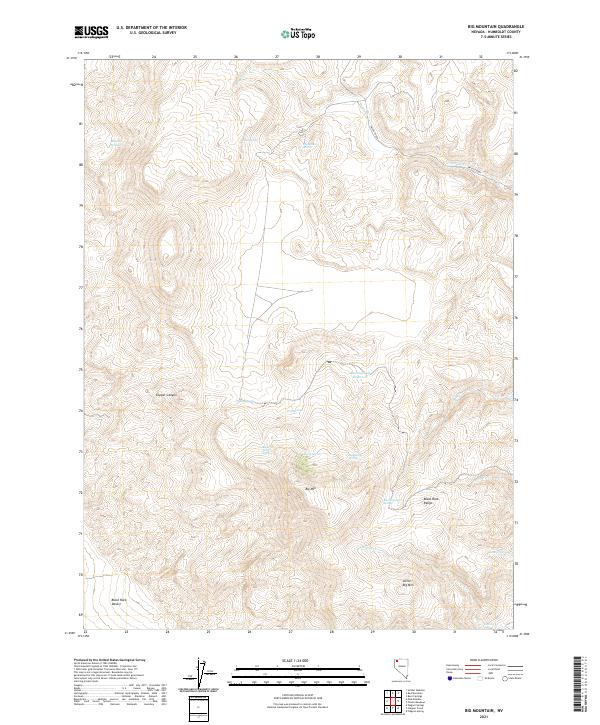
2021 Map of Big Mountain
USGS Topo · Published 2021About this map
Big Mtn and the neighboring Little Big Mtn dominate this high-desert landscape in northern Nevada. The terrain is defined by the sharp transition from the northwestern reaches of the Black Rock Desert into the elevated peaks of the Black Rock Range. This environment is punctuated by a network of critical water sources, from the Bawling Calf Reservoir to numerous family-named and wildlife-centric springs. Historically significant for ranching and passage through the Great Basin, the area's hydrology is carefully documented with named points such as Mustang Springs, Opal Spring, and Cancer Spring. The map reveals a remote territory where drainages like Paiute Creek and Copper Canyon carve through the basin and range geology, illustrating the sparse but vital water infrastructure of Humboldt County.
Find a feature on this map
25 named features on this map. Tap any name to fly to it.
Don’t see what you’re looking for? This feature index may not catch every label — zoom into the map to look around manually.
Map Details
Editions of this 2021 Big Mountain Map
This is the sole edition of this map. No revisions or reprints were ever made.
Other maps of this area

1886 · Disaster
USGS Topo · 1:250,000

1889 · Long Valley
USGS Topo · 1:250,000

1893 · Disaster
USGS Topo · 1:250,000

1954 · Vya
USGS Topo · 1:250,000

1958 · Vya
USGS Topo · 1:250,000

1962 · Vya
USGS Topo · 1:250,000

1972 · Mud Meadow
USGS Topo · 1:24,000

1972 · Soldier Meadow
USGS Topo · 1:24,000

1972 · Burnt Springs
USGS Topo · 1:24,000

1972 · Big Mountain
USGS Topo · 1:24,000