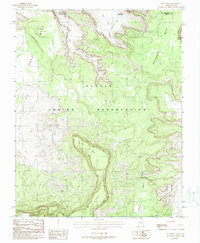
1988 Map of Big Point
USGS Topo · Published 1988About this map
Navajo Indian Reservation lands dominate this late-century landscape, defined by high-altitude plateaus and the deep erosion of the East Fork Copper Canyon and West Fork Copper Canyon. The sheer cliffs of Nokai Mesa and Hoskinnini Mesa overlook a network of seasonal drainages and isolated landforms like Begaashitahani. This 1988 provisional survey indicates a topography largely untouched by modern development, where transportation is limited to rugged 4wd tracks and footpaths. A rare sign of industrial activity is found near the northern edge, where Mine Shafts are marked atop a mesa. The presence of a Spring and the expansive Todicheenie Bench illustrate the vital, limited water sources and transitional terrain that characterize the high desert geography near the Utah-Arizona border.
Find a feature on this map
14 named features on this map. Tap any name to fly to it.
Don’t see what you’re looking for? This feature index may not catch every label — zoom into the map to look around manually.
Map Details
Editions of this 1988 Big Point Map
This is the sole edition of this map. No revisions or reprints were ever made.
Other maps of this area

1883 · Marsh Pass
USGS Topo · 1:250,000

1886 · Henry Mountains
USGS Topo · 1:250,000

1892 · Marsh Pass
USGS Topo · 1:250,000

1892 · Henry Mountains
USGS Topo · 1:250,000

1952 · Clay Hills 3 SE
USGS Topo · 1:24,000

1952 · Shato Spring 1 NE
USGS Topo · 1:24,000

1952 · Agathla Peak 2 SW
USGS Topo · 1:24,000

1952 · Agathla Peak 2 NW
USGS Topo · 1:24,000

1952 · Boot Mesa
USGS Topo · 1:62,500

1952 · Clay Hills 3 SW
USGS Topo · 1:24,000