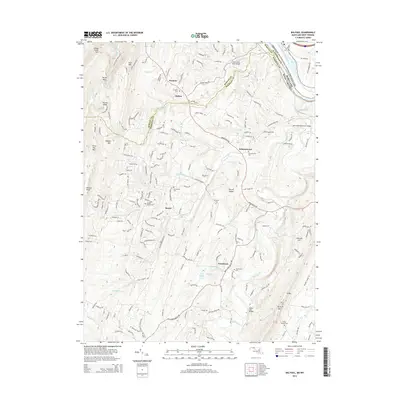
2014 Map of Big Pool
USGS Topo · Published 2014About this map
Back Creek winds through the heart of this landscape along the border of Morgan and Berkeley counties, illustrating the rural character of this region in the early 21st century. The map highlights several small communities including Johnsontown, Tomahawk, and Baxter, which are defined by their proximity to local water sources and mountain ridges. The northern edge of the sheet features the historic corridor of the Chesapeake and Ohio Canal National Historical Park and the namesake Big Pool along the Potomac River. Genealogists will find significant value in the distribution of family and community burial sites, such as Snyders Cem, Johnsontown Cem, and Hedges Chapel Cem. The topography is shaped by prominent heights like Third Hill Mtn and Sleepy Creek Mtn, while natural springs like Tomahawk Spring and the Boyd Rooney Farm Spring point to the area's geological reliance on groundwater.
Find a feature on this map
44 named features on this map. Tap any name to fly to it.
Don’t see what you’re looking for? This feature index may not catch every label — zoom into the map to look around manually.
Map Details
Editions of this 2014 Big Pool Map
This is the sole edition of this map. No revisions or reprints were ever made.
Other maps of this area

1884 · Harpers Ferry
USGS Topo · 1:125,000

1891 · Harpers Ferry
USGS Topo · 1:125,000

1893 · Harpers Ferry
USGS Topo · 1:125,000

1894 · Winchester
USGS Topo · 1:125,000

1899 · Hancock
USGS Topo · 1:62,500

1901 · Hancock
USGS Topo · 1:62,500

1912 · Williamsport
USGS Topo · 1:62,500

1914 · Martinsburg
USGS Topo · 1:48,000

1914 · Gerrardstown
USGS Topo · 1:48,000

1916 · Gerrardstown
USGS Topo · 1:62,500