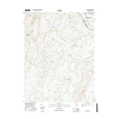
2016 Map of Big Pool
USGS Topo · Published 2016About this map
Johnsontown and the village of Tomahawk anchor this survey of the West Virginia panhandle, where the rugged slopes of North Mountain and Sleepy Creek Mountain enclose fertile valleys defined by Back Creek. The area's deep-rooted family history is evident in the numerous small burial grounds dotting the landscape, including Snyders Cemetery, Pittman Cemetery, and Riner Cemetery. Along the northern edge, the Potomac River flows past the Big Pool and the Chesapeake and Ohio Canal National Historical Park, marking the transition into Maryland.
Find a feature on this map
48 named features on this map. Tap any name to fly to it.
Don’t see what you’re looking for? This feature index may not catch every label — zoom into the map to look around manually.
Map Details
Editions of this 2016 Big Pool Map
This is the sole edition of this map. No revisions or reprints were ever made.
Other maps of this area

1884 · Harpers Ferry
USGS Topo · 1:125,000

1891 · Harpers Ferry
USGS Topo · 1:125,000

1893 · Harpers Ferry
USGS Topo · 1:125,000

1894 · Winchester
USGS Topo · 1:125,000

1899 · Hancock
USGS Topo · 1:62,500

1901 · Hancock
USGS Topo · 1:62,500

1912 · Williamsport
USGS Topo · 1:62,500

1914 · Martinsburg
USGS Topo · 1:48,000

1914 · Gerrardstown
USGS Topo · 1:48,000

1916 · Gerrardstown
USGS Topo · 1:62,500