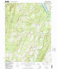
1998 Map of Big Pool
USGS Topo · Published 1999About this map
The Potomac River forms the central spine of this landscape at the intersection of Maryland and West Virginia, carving a deep valley bordered by the heights of Sleepy Creek Mountain and North Mountain. This 1990s record documents a region defined by historical transportation and conservation, where the Chesapeake and Ohio Canal parallels the river, protected within its namesake National Historical Park. Near the settlement of Big Pool, the expansive waters of the namesake Big Pool and the grounds of Fort Frederick State Park reflect the area's long-standing strategic importance along the Potomac corridor.
Find a feature on this map
48 named features on this map. Tap any name to fly to it.
Don’t see what you’re looking for? This feature index may not catch every label — zoom into the map to look around manually.
Map Details
Editions of this 1998 Big Pool Map
This is the sole edition of this map. No revisions or reprints were ever made.
Other maps of this area

1884 · Harpers Ferry
USGS Topo · 1:125,000

1891 · Harpers Ferry
USGS Topo · 1:125,000

1893 · Harpers Ferry
USGS Topo · 1:125,000

1894 · Winchester
USGS Topo · 1:125,000

1899 · Hancock
USGS Topo · 1:62,500

1901 · Hancock
USGS Topo · 1:62,500

1912 · Williamsport
USGS Topo · 1:62,500

1914 · Martinsburg
USGS Topo · 1:48,000

1914 · Gerrardstown
USGS Topo · 1:48,000

1916 · Gerrardstown
USGS Topo · 1:62,500