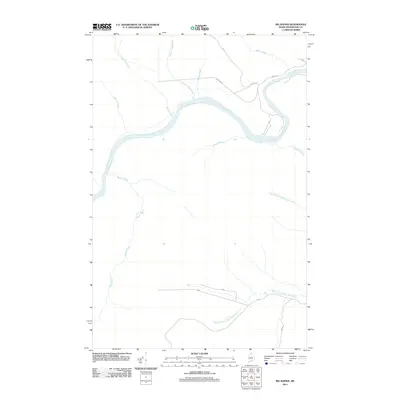
2011 Map of Big Rapids
USGS Topo · Published 2011About this map
The Saint John River dictates the geography of this northern Maine landscape, winding through a network of waterways that define the timber and sporting lands of Aroostook County. This 2011 survey captures the area at a time when the river remains the primary geographic anchor, joined by significant tributaries including Poplar Island Brook, Walker Brook, and Halfway Brook. The transportation network is dominated by logging and access routes like Camp 106 Rd and Rapid Rd, which pierce the woods to connect remote points. Cultural remnants of earlier settlement patterns are preserved in labels such as Old School House Rd and Dickey Gate, providing spatial clues for genealogists and local historians tracing the development of the Allagash wilderness. In the southern portion of the map, the forks of North Branch West Twin Brook and South Branch West Twin Brook further illustrate the intricate drainage system of this storied borderland.
Find a feature on this map
20 named features on this map. Tap any name to fly to it.
Don’t see what you’re looking for? This feature index may not catch every label — zoom into the map to look around manually.
Map Details
Editions of this 2011 Big Rapids Map
This is the sole edition of this map. No revisions or reprints were ever made.
Other maps of this area

1930 · Allagash
USGS Topo · 1:48,000

1932 · Allagash Falls
USGS Topo · 1:48,000

1933 · Allagash
USGS Topo · 1:62,500

1935 · Allagash Falls
USGS Topo · 1:62,500

1954 · Presque Isle
USGS Topo · 1:250,000

1955 · Rocky Mountain
USGS Topo · 1:62,500

1955 · Round Pond
USGS Topo · 1:62,500

1956 · Allagash Falls
USGS Topo · 1:50,000

1958 · Presque Isle
USGS Topo · 1:250,000

1960 · Presque Isle
USGS Topo · 1:250,000