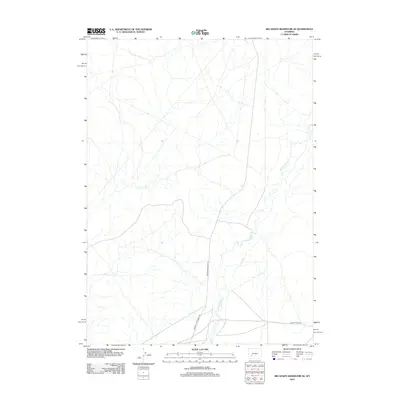
2012 Map of Big Sandy Reservoir SE
USGS Topo · Published 2012About this map
Little Sandy Cr defines the drainage patterns of this high-desert landscape in Sweetwater County. The map provides a detailed view of early 21st-century rural infrastructure, notably the Sublette Cutoff, a name that recalls the region’s deep history as a corridor for westward migration and overland travel. This survey documents the network of remote thoroughfares like Big Sandy Elkhorn Rd and Farson Little Sandy Rd, which serve the expansive ranching and energy lands of south-central Wyoming. The sparse distribution of named features underscores the open, arid nature of the terrain northeast of Farson, where water sources and established trail routes have historically dictated human movement and settlement.
Find a feature on this map
4 named features on this map. Tap any name to fly to it.
Don’t see what you’re looking for? This feature index may not catch every label — zoom into the map to look around manually.
Map Details
Editions of this 2012 Big Sandy Reservoir SE Map
This is the sole edition of this map. No revisions or reprints were ever made.
Other maps of this area

1955 · Lander
USGS Topo · 1:250,000

1958 · Lander
USGS Topo · 1:250,000

1958 · Parting of the Ways
USGS Topo · 1:62,500

1958 · Essex Mountain
USGS Topo · 1:62,500

1958 · Tule Butte
USGS Topo · 1:24,000

1958 · Parting of the Ways
USGS Topo · 1:24,000

1961 · Lander
USGS Topo · 1:250,000

1968 · Eden Reservoir East
USGS Topo · 1:24,000
1968 · Eden Reservoir West
USGS Topo · 1:24,000

1969 · Leckie Reservoir
USGS Topo · 1:24,000