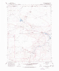
1966 Map of Big Spring Butte
USGS Topo · Published 1977About this map
The high desert landscape of the Charles Sheldon Antelope Range defines this remote stretch of the Nevada-Oregon border. In the mid-1960s, this area was characterized by wide plateaus like Big Spring Table and Gooch Table, where water sources were critical for both wildlife and sparse human activity. Named features such as McKenney Camp and Gooch Camp suggest the seasonal rhythms of ranching or wildlife management, while Virgin Valley Ranch sits near the heart of the Virgin Valley.
Find a feature on this map
39 named features on this map. Tap any name to fly to it.
Don’t see what you’re looking for? This feature index may not catch every label — zoom into the map to look around manually.
Map Details
Editions of this 1966 Big Spring Butte Map
2 editions found

Other maps of this area

1886 · Disaster
USGS Topo · 1:250,000

1889 · Long Valley
USGS Topo · 1:250,000

1893 · Disaster
USGS Topo · 1:250,000

1954 · Vya
USGS Topo · 1:250,000

1955 · Adel
USGS Topo · 1:250,000

1957 · Adel
USGS Topo · 1:250,000

1958 · Vya
USGS Topo · 1:250,000

1958 · Adel
USGS Topo · 1:250,000

1962 · Vya
USGS Topo · 1:250,000

1962 · Adel
USGS Topo · 1:250,000