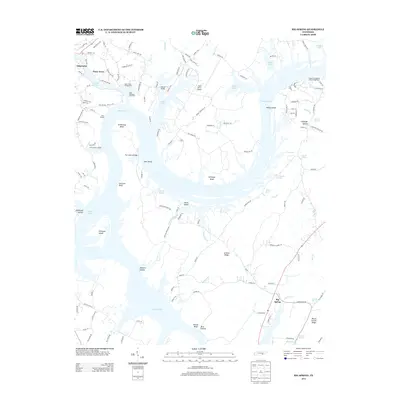
2013 Map of Big Spring
USGS Topo · Published 2013About this map
Dallas Lake and the Tennessee River's winding course dominate this 2013 survey of the landscape near Big Spring. The river's path is marked by dramatic geographical features such as Armstrong Bend and Gillespie Bend, alongside the prominent Hiwassee Island. This era shows a mix of recreational infrastructure and rural aviation, with Blue Water Campground and Mark Anton Airport serving as key local landmarks.
Find a feature on this map
136 named features on this map. Tap any name to fly to it.
Don’t see what you’re looking for? This feature index may not catch every label — zoom into the map to look around manually.
Map Details
Editions of this 2013 Big Spring Map
This is the sole edition of this map. No revisions or reprints were ever made.
Other maps of this area

1886 · Cleveland
USGS Topo · 1:125,000

1887 · Kingston
USGS Topo · 1:125,000

1888 · Chattanooga
USGS Topo · 1:125,000

1891 · Kingston
USGS Topo · 1:125,000

1892 · Pikeville
USGS Topo · 1:125,000

1892 · Cleveland
USGS Topo · 1:125,000

1893 · Chattanooga
USGS Topo · 1:125,000

1893 · Kingston
USGS Topo · 1:125,000

1895 · Cleveland
USGS Topo · 1:125,000

1895 · Pikeville
USGS Topo · 1:125,000