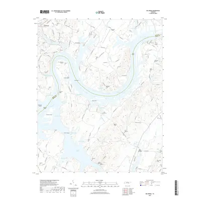
2019 Map of Big Spring
USGS Topo · Published 2019About this map
Chickamauga Lake and the winding Tennessee River dominate this landscape along the border of Rhea and Meigs Counties. The river's path is marked by a complex network of backwaters and navigation points, including Kellys Shoals, Leas Shoals, and several low-lying islands like Hiwassee Island and Moon Island. The terrain is characterized by prominent elevations such as Garrison Bluff and Mt Carmel Ridge, which overlook numerous family-named hollows and sloughs. For those tracing local history, the map provides a high density of small burial grounds, from the Shaver Cem in the north to Mount Carmel Cem in the southeast. Transportation infrastructure is represented by the Mark Anton Airport and river crossings like The Culbert Bridge and Rattan Bridge, illustrating how modern connectivity integrates with the traditional riverside topography near Dayton and the settlement of Big Spring.
Find a feature on this map
141 named features on this map. Tap any name to fly to it.
Don’t see what you’re looking for? This feature index may not catch every label — zoom into the map to look around manually.
Map Details
Editions of this 2019 Big Spring Map
This is the sole edition of this map. No revisions or reprints were ever made.
Other maps of this area

1886 · Cleveland
USGS Topo · 1:125,000

1887 · Kingston
USGS Topo · 1:125,000

1888 · Chattanooga
USGS Topo · 1:125,000

1891 · Kingston
USGS Topo · 1:125,000

1892 · Pikeville
USGS Topo · 1:125,000

1892 · Cleveland
USGS Topo · 1:125,000

1893 · Chattanooga
USGS Topo · 1:125,000

1893 · Kingston
USGS Topo · 1:125,000

1895 · Cleveland
USGS Topo · 1:125,000

1895 · Pikeville
USGS Topo · 1:125,000