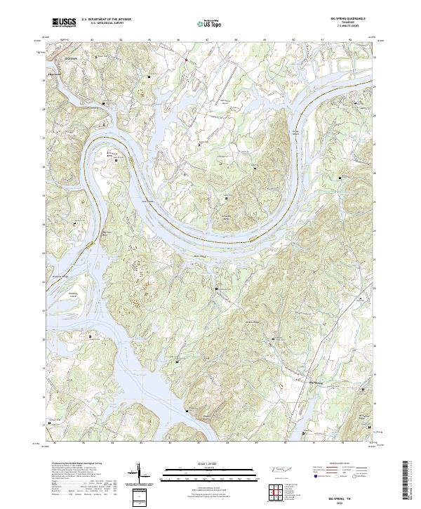
2022 Map of Big Spring
USGS Topo · Published 2022About this map
The Tennessee River carves a winding path through the landscape of Rhea and Meigs counties, creating prominent features like Armstrong Bend and Gillespie Bend. This riverine environment is defined by its complex hydrology, featuring numerous sloughs and islands such as Hiwassee Island and Moon Island at the confluence with the Hiwassee River. The area maintains a strong agricultural and rural character, evidenced by the high density of family and community burial grounds, including the Sullivan Cem, Blankenship Cem, and Good Hope Cem. Local navigation and travel are anchored by landmarks like the Mark Anton Airport and river crossings near Kellys Shoals. Small settlements like Big Spring and Dayton serve as regional hubs, connected by a network of rural roads that skirt around Jenkins Ridge and Mount Carmel Ridge.
Find a feature on this map
153 named features on this map. Tap any name to fly to it.
Don’t see what you’re looking for? This feature index may not catch every label — zoom into the map to look around manually.
Map Details
Editions of this 2022 Big Spring Map
This is the sole edition of this map. No revisions or reprints were ever made.
Other maps of this area

1886 · Cleveland
USGS Topo · 1:125,000

1887 · Kingston
USGS Topo · 1:125,000

1888 · Chattanooga
USGS Topo · 1:125,000

1891 · Kingston
USGS Topo · 1:125,000

1892 · Pikeville
USGS Topo · 1:125,000

1892 · Cleveland
USGS Topo · 1:125,000

1893 · Chattanooga
USGS Topo · 1:125,000

1893 · Kingston
USGS Topo · 1:125,000

1895 · Cleveland
USGS Topo · 1:125,000

1895 · Pikeville
USGS Topo · 1:125,000