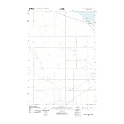
2010 Map of Big Stone Lake SE
USGS Topo · Published 2010About this map
Big Stone Lake and the winding tributaries of the Whetstone River define this corner of Grant County, South Dakota, along the Minnesota border. The landscape is dominated by a strict grid of section roads, including 139th St and 482nd Ave, which carve through the prairie towards the lake's southern reaches. Near the shoreline, Camp Tepeetonka stands as a notable landmark overlooking the water, situated just north of the residential development at Manhattan Island.
Find a feature on this map
23 named features on this map. Tap any name to fly to it.
Don’t see what you’re looking for? This feature index may not catch every label — zoom into the map to look around manually.
Map Details
Editions of this 2010 Big Stone Lake SE Map
This is the sole edition of this map. No revisions or reprints were ever made.
Other maps of this area

1953 · Ortonville
USGS Topo · 1:62,500

1953 · Bellingham
USGS Topo · 1:62,500

1953 · Milbank
USGS Topo · 1:250,000

1954 · Big Stone Lake
USGS Topo · 1:62,500

1958 · Milbank
USGS Topo · 1:250,000

1971 · Big Stone Lake East
USGS Topo · 1:24,000

1971 · Big Stone Lake West
USGS Topo · 1:24,000

1971 · Rosen
USGS Topo · 1:24,000

1971 · Big Stone Lake SE
USGS Topo · 1:24,000

1971 · Big Stone Lake SW
USGS Topo · 1:24,000