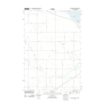
2012 Map of Big Stone Lake SE
USGS Topo · Published 2012About this map
Big Stone Lake dominates the northeastern corner of this Grant County landscape, where the waters are punctuated by Goose Island and Manhattan Island. Along the shoreline, Camp Tepeetonka stands as a focal point for recreation and community gathering. The terrain is defined by its drainage patterns, most notably where the N Fork Whetstone River and S Fork Whetstone River converge to form the main channel of the Whetstone River. This 2012 survey illustrates the modern agricultural grid of the eastern South Dakota plains, with a highly organized network of section-line roads like 480th Ave and 145th St providing access to the expansive farmsteads between the river forks. The map provides a clear view of the hydrological interface between the river system and the glacial lake, highlighting the importance of these water resources to the regional identity.
Find a feature on this map
22 named features on this map. Tap any name to fly to it.
Don’t see what you’re looking for? This feature index may not catch every label — zoom into the map to look around manually.
Map Details
Editions of this 2012 Big Stone Lake SE Map
This is the sole edition of this map. No revisions or reprints were ever made.
Other maps of this area

1953 · Ortonville
USGS Topo · 1:62,500

1953 · Bellingham
USGS Topo · 1:62,500

1953 · Milbank
USGS Topo · 1:250,000

1954 · Big Stone Lake
USGS Topo · 1:62,500

1958 · Milbank
USGS Topo · 1:250,000

1971 · Big Stone Lake East
USGS Topo · 1:24,000

1971 · Big Stone Lake West
USGS Topo · 1:24,000

1971 · Rosen
USGS Topo · 1:24,000

1971 · Big Stone Lake SE
USGS Topo · 1:24,000

1971 · Big Stone Lake SW
USGS Topo · 1:24,000