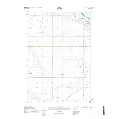
2017 Map of Big Stone Lake SE
USGS Topo · Published 2017About this map
Big Stone Lake forms the primary geographic boundary at the northeastern corner of this landscape, separating South Dakota from Minnesota. This section of Grant County and Roberts County is defined by the wandering path of the Whetstone River, which meanders eastward toward the lake through a series of dramatic bends. The confluence of the N Fork Whetstone River and the southern fork illustrates the natural drainage patterns of this prairie region. Notable landforms within the lake itself include Goose Island and Manhattan Island, which sit just offshore from the South Dakota side. The surrounding upland is organized by a strict section-line road grid, including routes like Eagle View Lake Rd and Frevert Farm Rd, reflecting the enduring agricultural character of the region as it transitioned into the early twenty-first century.
Find a feature on this map
25 named features on this map. Tap any name to fly to it.
Don’t see what you’re looking for? This feature index may not catch every label — zoom into the map to look around manually.
Map Details
Editions of this 2017 Big Stone Lake SE Map
This is the sole edition of this map. No revisions or reprints were ever made.
Other maps of this area

1953 · Ortonville
USGS Topo · 1:62,500

1953 · Bellingham
USGS Topo · 1:62,500

1953 · Milbank
USGS Topo · 1:250,000

1954 · Big Stone Lake
USGS Topo · 1:62,500

1958 · Milbank
USGS Topo · 1:250,000

1971 · Big Stone Lake East
USGS Topo · 1:24,000

1971 · Big Stone Lake West
USGS Topo · 1:24,000

1971 · Rosen
USGS Topo · 1:24,000

1971 · Big Stone Lake SE
USGS Topo · 1:24,000

1971 · Big Stone Lake SW
USGS Topo · 1:24,000