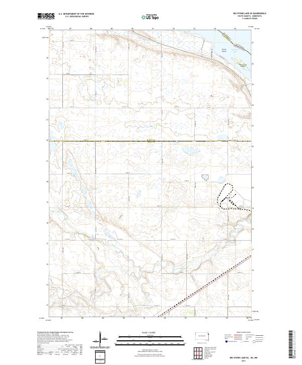
2021 Map of Big Stone Lake SE
USGS Topo · Published 2021About this map
Big Stone Lake anchors the northeastern corner of this South Dakota and Minnesota borderland, defining a landscape shaped by the convergence of glacial water and agricultural development. The map follows the meandering path of the Whetstone River as it winds through the southern half of the quadrangle, joined by the N Fork Whetstone River and S Fork Whetstone River. This fluvial network is set against a grid of sectional roads like 479th Ave and Co Hwy 4, illustrating the persistent structure of the Public Land Survey System.
Find a feature on this map
35 named features on this map. Tap any name to fly to it.
Don’t see what you’re looking for? This feature index may not catch every label — zoom into the map to look around manually.
Map Details
Editions of this 2021 Big Stone Lake SE Map
This is the sole edition of this map. No revisions or reprints were ever made.
Other maps of this area

1953 · Ortonville
USGS Topo · 1:62,500

1953 · Bellingham
USGS Topo · 1:62,500

1953 · Milbank
USGS Topo · 1:250,000

1954 · Big Stone Lake
USGS Topo · 1:62,500

1958 · Milbank
USGS Topo · 1:250,000

1971 · Big Stone Lake East
USGS Topo · 1:24,000

1971 · Big Stone Lake West
USGS Topo · 1:24,000

1971 · Rosen
USGS Topo · 1:24,000

1971 · Big Stone Lake SE
USGS Topo · 1:24,000

1971 · Big Stone Lake SW
USGS Topo · 1:24,000