
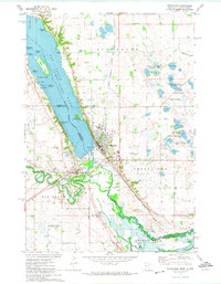
1971 Map of Big Stone Lake SE
USGS Topo · Published 1974About this map
The Old Indian Treaty Boundary slices diagonally across the southwestern corner of this 1971 landscape, marking a historical line of demarcation in eastern South Dakota. This map captures the varied terrain of Grant Co and Roberts Co at the edge of Big Stone Lake. Notable landmarks include Camp Tepeetonka and several islands such as Goose Island and Manhattan Island. The region is defined by the convergence of the North Fork and South Fork Whetstone River, which feed into the primary lake basin. Extensive conservation efforts are visible through the National Waterfowl Production Area and the State Wildlife Management Area. Transport infrastructure is anchored by the Chicago Milwaukee St Paul and Pacific Railroad, which follows an Old Grade through the river valley near a local Roadside Park.
Find a feature on this map
20 named features on this map. Tap any name to fly to it.
Don’t see what you’re looking for? This feature index may not catch every label — zoom into the map to look around manually.
Map Details
Editions of this 1971 Big Stone Lake SE Map
This is the sole edition of this map. No revisions or reprints were ever made.
Other maps of this area

1953 · Ortonville
USGS Topo · 1:62,500

1953 · Bellingham
USGS Topo · 1:62,500

1953 · Milbank
USGS Topo · 1:250,000

1954 · Big Stone Lake
USGS Topo · 1:62,500

1958 · Milbank
USGS Topo · 1:250,000

1971 · Big Stone Lake East
USGS Topo · 1:24,000

1971 · Big Stone Lake West
USGS Topo · 1:24,000

1971 · Rosen
USGS Topo · 1:24,000

1971 · Big Stone Lake SW
USGS Topo · 1:24,000
1971 · Ortonville
USGS Topo · 1:24,000