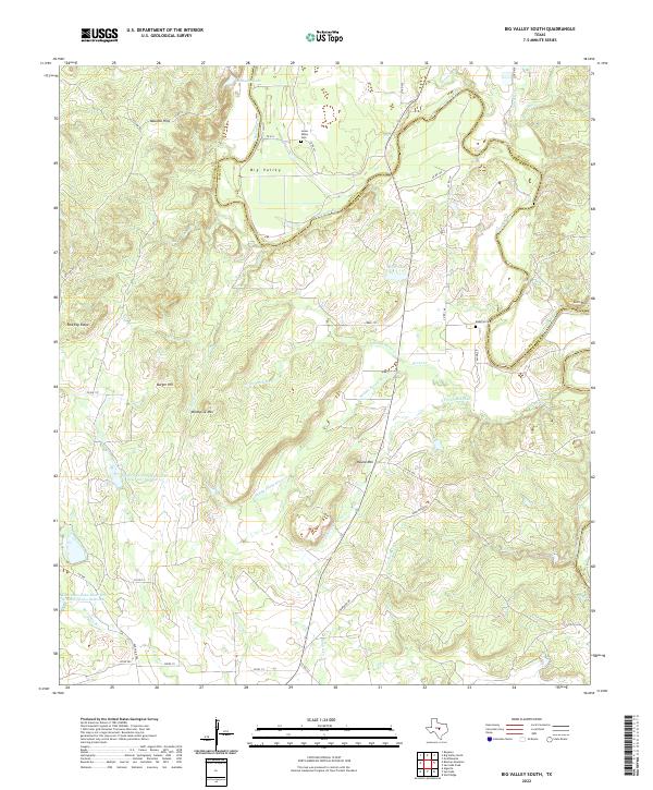
2022 Map of Big Valley South
USGS Topo · Published 2022About this map
The Colorado River carves a winding path through the borderlands of San Saba and Mills Counties, defining the northern landscape of this central Texas quadrangle. The settlement of Big Valley serves as a local focal point near the river's edge, surrounded by family burial grounds like Lower Valley Cem and McMillin Cem. This era of the landscape is defined by modern water management and ranching infrastructure, evidenced by the Lower San Saba Watershed Reservoir Number 10 and Lower San Saba River WS SCS-Site-Twelve Reservoir.
Find a feature on this map
48 named features on this map. Tap any name to fly to it.
Don’t see what you’re looking for? This feature index may not catch every label — zoom into the map to look around manually.
Map Details
Editions of this 2022 Big Valley South Map
This is the sole edition of this map. No revisions or reprints were ever made.
Other maps of this area

1885 · San Saba
USGS Topo · 1:125,000

1894 · San Saba
USGS Topo · 1:125,000

1925 · San Saba 4-a
USGS Topo · 1:48,000

1925 · San Saba 2-a
USGS Topo · 1:48,000

1925 · San Saba 1-c
USGS Topo · 1:48,000

1925 · San Saba 1-b
USGS Topo · 1:48,000

1925 · San Saba 1-d
USGS Topo · 1:48,000

1928 · Goldthwaite
USGS Topo · 1:62,500

1930 · Richland Springs
USGS Topo · 1:62,500

1931 · Bend
USGS Topo · 1:62,500