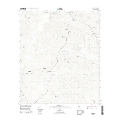
2014 Map of Bigbee
USGS Topo · Published 2014About this map
Bigbee and Ellisville serve as central nodes in this rural Washington County landscape, where the terrain is deeply etched by a complex drainage system including the North, Middle, and South Prongs of Tauler Creek. Small, dispersed settlements like Carpenter and Jordan are connected by a network of local roads such as Chatom Bigbee Rd and Carpenter Rd, reflecting the area's timber and agricultural heritage. Family and community history is preserved in several rural burial grounds, including Three Forks Cem and Wesley Chapel Cem, which anchor the northern reaches of the map.
Find a feature on this map
43 named features on this map. Tap any name to fly to it.
Don’t see what you’re looking for? This feature index may not catch every label — zoom into the map to look around manually.
Map Details
Editions of this 2014 Bigbee Map
This is the sole edition of this map. No revisions or reprints were ever made.
Other maps of this area

1943 · McIntosh
USGS Topo · 1:62,500

1944 · McIntosh
USGS Topo · 1:62,500

1953 · Hattiesburg
USGS Topo · 1:250,000

1958 · Hattiesburg
USGS Topo · 1:250,000

1971 · Bigbee
USGS Topo · 1:24,000

1971 · Bladon Springs
USGS Topo · 1:24,000

1972 · Tattlersville
USGS Topo · 1:24,000

1972 · St. Stephens
USGS Topo · 1:24,000

1974 · Millry South
USGS Topo · 1:24,000

1974 · Chatom
USGS Topo · 1:24,000