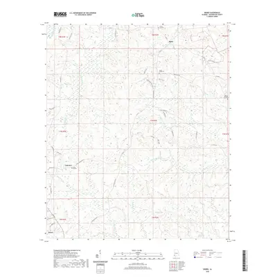
2020 Map of Bigbee
USGS Topo · Published 2020About this map
Bigbee, Carpenter, and Jordan anchor this rural landscape in Washington County, where timber and small-scale agriculture define the terrain. The hydrology of the region is complex, dominated by the branching system of N Prong Tauler Cr, Middle Prong Tauler Cr, and S Prong Tauler Cr, which drain into the southern Bull Hall Swamp. Family and community history is preserved in localized landmarks such as Spring Hill Cem near Carpenter and Wesley Chapel Cem further north. The map reveals a network of local thoroughfares like Chatom Bigbee Rd and Race Track Rd, illustrating how these dispersed settlements were interconnected before more modern infrastructure changes. In the southeast, Midway Methodist Church Cem serves as a final point of reference for the Elias and Fly Branch watersheds.
Find a feature on this map
53 named features on this map. Tap any name to fly to it.
Don’t see what you’re looking for? This feature index may not catch every label — zoom into the map to look around manually.
Map Details
Editions of this 2020 Bigbee Map
This is the sole edition of this map. No revisions or reprints were ever made.
Other maps of this area

1943 · McIntosh
USGS Topo · 1:62,500

1944 · McIntosh
USGS Topo · 1:62,500

1953 · Hattiesburg
USGS Topo · 1:250,000

1958 · Hattiesburg
USGS Topo · 1:250,000

1971 · Bigbee
USGS Topo · 1:24,000

1971 · Bladon Springs
USGS Topo · 1:24,000

1972 · Tattlersville
USGS Topo · 1:24,000

1972 · St. Stephens
USGS Topo · 1:24,000

1974 · Millry South
USGS Topo · 1:24,000

1974 · Chatom
USGS Topo · 1:24,000