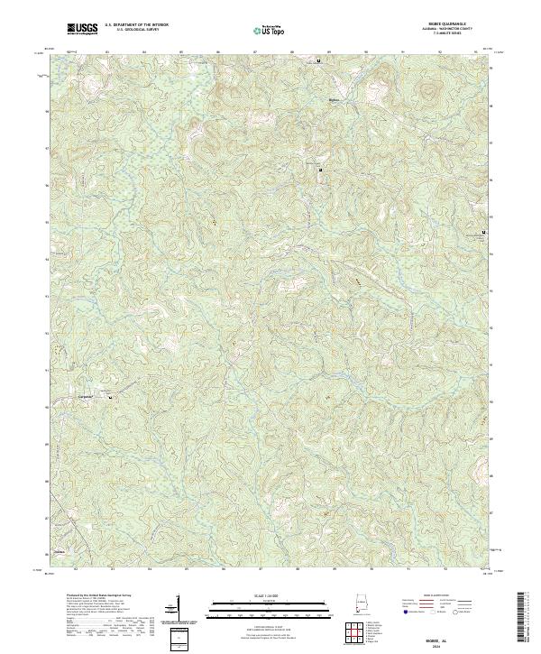
2024 Map of Bigbee
USGS Topo · Published 2024About this map
Bigbee and Carpenter anchor a landscape defined by the intricate headwaters of the Tauler Creek system in Washington County. The terrain is marked by a network of rural roads such as Chatom Bigbee Rd and Co Rd 34, which connect scattered homesteads and local landmarks. Genealogists will find significant value in the documentation of several community burial grounds, including Spring Hill Cem near Carpenter and Three Forks Cem to the north. Further east, the Midway Methodist Church Cem serves as a prominent focal point near the township line. The map reveals a highly dissected topography where numerous seasonal watercourses like Santa Bogue Creek, Fly Branch, and Simmons Creek carve through the timberlands, illustrating the traditional settlement patterns and drainage-dependent land use of the Alabama interior.
Find a feature on this map
51 named features on this map. Tap any name to fly to it.
Don’t see what you’re looking for? This feature index may not catch every label — zoom into the map to look around manually.
Map Details
Editions of this 2024 Bigbee Map
This is the sole edition of this map. No revisions or reprints were ever made.
Other maps of this area

1943 · McIntosh
USGS Topo · 1:62,500

1944 · McIntosh
USGS Topo · 1:62,500

1953 · Hattiesburg
USGS Topo · 1:250,000

1958 · Hattiesburg
USGS Topo · 1:250,000

1971 · Bigbee
USGS Topo · 1:24,000

1971 · Bladon Springs
USGS Topo · 1:24,000

1972 · Tattlersville
USGS Topo · 1:24,000

1972 · St. Stephens
USGS Topo · 1:24,000

1974 · Millry South
USGS Topo · 1:24,000

1974 · Chatom
USGS Topo · 1:24,000