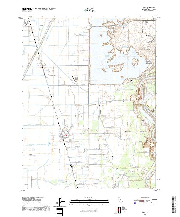
2021 Map of Biggs
USGS Topo · Published 2021About this map
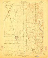
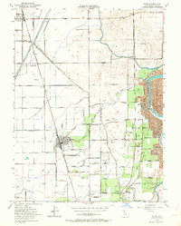
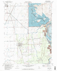
Biggs stands as a central settlement in this portion of the Sacramento Valley, defined by a highly engineered water management system essential for local agriculture. The landscape is a network of irrigation and drainage infrastructure, including the Main Drainage Canal, High Lift Lateral, and Cherokee Canal, which support the surrounding fields. To the northeast, the massive Thermalito Afterbay regulates water levels near the Oroville city limits, while the Feather River winds along the eastern edge of the quadrangle. Smaller rural communities like Riceton, East Biggs, and Peachton are connected by a grid of agricultural roads and the primary corridor of Railroad Ave. Historical markers of the area's development are preserved at the Old Hamilton Cem and Gridley - Biggs Cem, providing important touchstones for local genealogical research in Butte County.
Find a feature on this map
115 named features on this map. Tap any name to fly to it.
Don’t see what you’re looking for? This feature index may not catch every label — zoom into the map to look around manually.
Map Details
Editions of this 2021 Biggs Map
This is the sole edition of this map. No revisions or reprints were ever made.
Historical Maps of Peachton Through Time
4 maps found