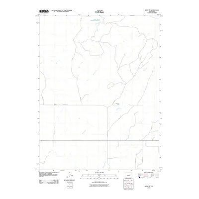
2010 Map of Bijou SW
USGS Topo · Published 2010About this map
Middle Bijou Creek and its various tributaries define the drainage patterns of this high plains landscape in Elbert County. The geography is characterized by a network of intermittent waterways, including Wilson Creek, Bland Creek, and East Bijou Creek, which converge as they move through the ranching country. At the intersection of County Rd-91 and County Rd-122, the Norton Cemetery serves as a significant local landmark for genealogists and family historians. Infrastructure in this area is primarily geared toward agricultural water management, as evidenced by the Walter Burns Detention Reservoir in the northern reaches of the quadrangle. While the landscape remains largely open, the presence of Brittingham Ranch and a sparse grid of rural routes like Ridge Rd and County Rd-105 indicate the enduring ranching economy of the region.
Find a feature on this map
14 named features on this map. Tap any name to fly to it.
Don’t see what you’re looking for? This feature index may not catch every label — zoom into the map to look around manually.
Map Details
Editions of this 2010 Bijou SW Map
This is the sole edition of this map. No revisions or reprints were ever made.
Other maps of this area
1953 · Denver
USGS Topo · 1:250,000
1957 · Denver
USGS Topo · 1:250,000
1958 · Denver
USGS Topo · 1:250,000
1960 · Denver
USGS Topo · 1:250,000
1970 · Kiowa NE
USGS Topo · 1:24,000
1970 · Big Gulch
USGS Topo · 1:24,000
1970 · Cattle Gulch
USGS Topo · 1:24,000
1970 · Fondis
USGS Topo · 1:24,000
1970 · Bijou SW
USGS Topo · 1:24,000
1970 · Bijou
USGS Topo · 1:24,000