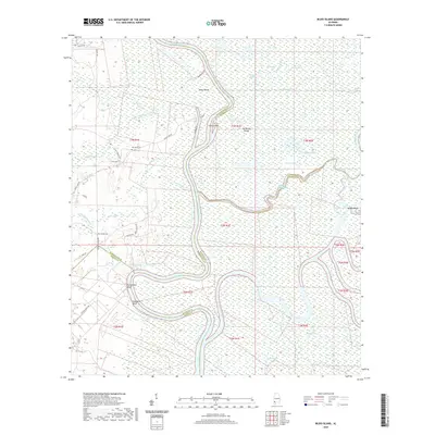
2020 Map of Bilbo Island
USGS Topo · Published 2020About this map
Nanahubba Bluff and Seaboard Bluff overlook the confluence where the Tombigbee River and Alabama River merge to form the Mobile River. This hydrological nexus is characterized by a complex network of wetlands and secondary channels, including Joe Bayou, Turpin Slough, and the Alabama River Cutoff. To the north, Bilbo Island is defined by the West River, while the western uplands show traces of local heritage at the Big John Cem. The landscape is a maze of named waterways such as Bearpen Gut, Halls Gut, and Alligator Slide, illustrating a riverine environment that remains largely dominated by its natural drainage patterns. Road access is limited to the western margins near Bates Lake Rd and Thyssen Krupp Dr, leaving the interior river islands and sloughs primarily accessible by water.
Find a feature on this map
49 named features on this map. Tap any name to fly to it.
Don’t see what you’re looking for? This feature index may not catch every label — zoom into the map to look around manually.
Map Details
Editions of this 2020 Bilbo Island Map
This is the sole edition of this map. No revisions or reprints were ever made.
Other maps of this area

1943 · Choctaw Bluff
USGS Topo · 1:62,500

1943 · Tensaw
USGS Topo · 1:62,500

1943 · Citronelle
USGS Topo · 1:62,500

1943 · McIntosh
USGS Topo · 1:62,500

1944 · McIntosh
USGS Topo · 1:62,500

1944 · Tensaw
USGS Topo · 1:62,500

1946 · Citronelle
USGS Topo · 1:62,500

1946 · Choctaw Bluff
USGS Topo · 1:62,500

1953 · Andalusia
USGS Topo · 1:250,000

1953 · Hattiesburg
USGS Topo · 1:250,000