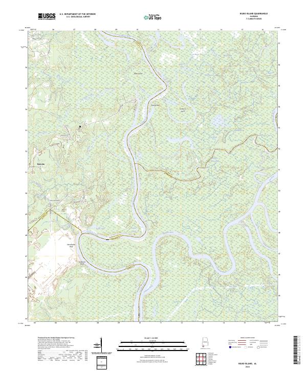
2024 Map of Bilbo Island
USGS Topo · Published 2024About this map
Bilbo Island sits at the massive hydrologic confluence where the Tombigbee River and Alabama River meet to form the Mobile River. This modern topographic survey details a complex deltaic landscape defined by shifting watercourses, including West River, Alligator Slide, and the Alabama River Cutoff. On the western shore, the small settlement of Malcolm and the Big John Cem provide anchors of human history against the rising elevations of Nanahubba Bluff and Seaboard Bluff. The map illustrates the intricate relationship between four Alabama counties—Washington, Clarke, Baldwin, and Mobile—which intersect along these winding river boundaries. Local landmarks like Jim Burns Island and various
Find a feature on this map
49 named features on this map. Tap any name to fly to it.
Don’t see what you’re looking for? This feature index may not catch every label — zoom into the map to look around manually.
Map Details
Editions of this 2024 Bilbo Island Map
This is the sole edition of this map. No revisions or reprints were ever made.
Other maps of this area

1943 · Choctaw Bluff
USGS Topo · 1:62,500

1943 · Tensaw
USGS Topo · 1:62,500

1943 · Citronelle
USGS Topo · 1:62,500

1943 · McIntosh
USGS Topo · 1:62,500

1944 · McIntosh
USGS Topo · 1:62,500

1944 · Tensaw
USGS Topo · 1:62,500

1946 · Citronelle
USGS Topo · 1:62,500

1946 · Choctaw Bluff
USGS Topo · 1:62,500

1953 · Andalusia
USGS Topo · 1:250,000

1953 · Hattiesburg
USGS Topo · 1:250,000