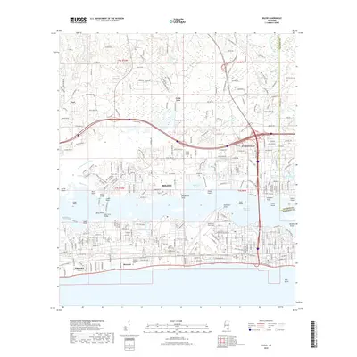
2018 Map of Biloxi
USGS Topo · Published 2018About this map
Biloxi and D'Iberville are documented here along the Mississippi Sound, showing a landscape defined by the winding Tchoutacabouffa River and the expansive Back Bay of Biloxi. The map captures the significant footprint of Keesler Air Force Base alongside historic sites like Beauvoir, the post-Civil War home of Jefferson Davis. Coastal features such as Deer Island, Marsh Island, and Goat Island are clearly delineated, illustrating the complex shoreline of the gulf coast. Urban development is detailed through established neighborhoods like Edgewater Park and Wool Market, with prominent corridors such as Beach Blvd and Old Hwy 67 connecting the region. Local history is further grounded by the presence of the Old French Cem and Southern Memorial Park, providing valuable points of reference for genealogists and researchers exploring the cultural fabric of Harrison County.
Find a feature on this map
51 named features on this map. Tap any name to fly to it.
Don’t see what you’re looking for? This feature index may not catch every label — zoom into the map to look around manually.
Map Details
Editions of this 2018 Biloxi Map
This is the sole edition of this map. No revisions or reprints were ever made.
Other maps of this area

1953 · Mobile
USGS Topo · 1:250,000

1954 · Vestry
USGS Topo · 1:62,500

1954 · McHenry
USGS Topo · 1:62,500

1954 · Gulfport North
USGS Topo · 1:24,000

1954 · Gulfport South
USGS Topo · 1:24,000

1954 · Ocean Springs
USGS Topo · 1:24,000

1954 · Biloxi
USGS Topo · 1:24,000

1954 · Deer Island
USGS Topo · 1:24,000

1954 · Biloxi
USGS Topo · 1:62,500

1957 · Mobile
USGS Topo · 1:250,000