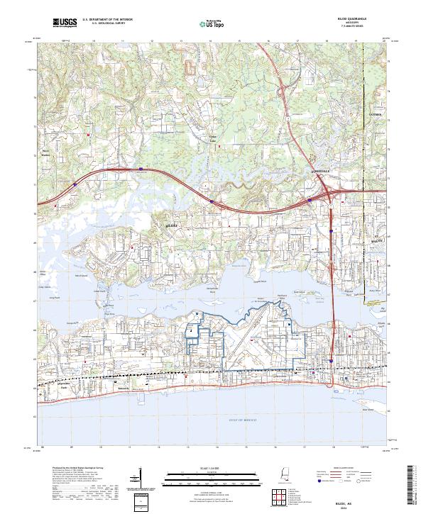
2024 Map of Biloxi
USGS Topo · Published 2024About this map
The Back Bay of Biloxi and the Gulf of Mexico define this coastal landscape, where the Tchoutacabouffa River and Biloxi River converge into the sound. The urban development of Biloxi and D'Iberville is bisected by the massive footprint of Keesler Air Force Base, while the coastline preserves significant historical sites like the Beauvoir estate. Genealogists and researchers will find notable burial grounds including the Biloxi National Cem and the Beauvoir Confederate Cem.
Find a feature on this map
58 named features on this map. Tap any name to fly to it.
Don’t see what you’re looking for? This feature index may not catch every label — zoom into the map to look around manually.
Map Details
Editions of this 2024 Biloxi Map
This is the sole edition of this map. No revisions or reprints were ever made.
Other maps of this area

1953 · Mobile
USGS Topo · 1:250,000

1954 · Vestry
USGS Topo · 1:62,500

1954 · McHenry
USGS Topo · 1:62,500

1954 · Gulfport North
USGS Topo · 1:24,000

1954 · Gulfport South
USGS Topo · 1:24,000

1954 · Ocean Springs
USGS Topo · 1:24,000

1954 · Biloxi
USGS Topo · 1:24,000

1954 · Deer Island
USGS Topo · 1:24,000

1954 · Biloxi
USGS Topo · 1:62,500

1957 · Mobile
USGS Topo · 1:250,000