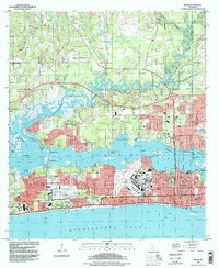
1992 Map of Biloxi
USGS Topo · Published 1998About this map
The Tchoutacabouffa River winds through the northern landscape of this Mississippi coast survey, eventually widening into Big Lake and the Back Bay Biloxi. This 1990s update, based on topography from the 1950s, reveals a densely developed coastline where military and veteran institutions anchor the community. The massive Keesler Air Force Base dominates the southern peninsula, while the Veterans Administration Center sits nearby, highlighting the area's long-standing strategic importance.
Find a feature on this map
63 named features on this map. Tap any name to fly to it.
Don’t see what you’re looking for? This feature index may not catch every label — zoom into the map to look around manually.
Map Details
Editions of this 1992 Biloxi Map
This is the sole edition of this map. No revisions or reprints were ever made.
Other maps of this area

1953 · Mobile
USGS Topo · 1:250,000

1954 · Vestry
USGS Topo · 1:62,500

1954 · McHenry
USGS Topo · 1:62,500

1954 · Gulfport North
USGS Topo · 1:24,000

1954 · Gulfport South
USGS Topo · 1:24,000

1954 · Ocean Springs
USGS Topo · 1:24,000

1954 · Biloxi
USGS Topo · 1:24,000

1954 · Deer Island
USGS Topo · 1:24,000

1954 · Biloxi
USGS Topo · 1:62,500

1957 · Mobile
USGS Topo · 1:250,000