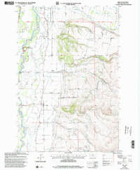
1998 Map of Bing
USGS Topo · Published 2002About this map
The Bitterroot River meanders through this western Montana landscape, defining a valley where agriculture and transport infrastructure converge. Irrigation is central to the area's development, evidenced by the Irrigation District Canal and numerous ditches that feed the fields surrounding Bing and Victor Siding. The Union Pacific rail line and the East Side Highway parallel the river, tracing the same natural corridor as the Lewis and Clark Trail. To the east, the terrain rises sharply into the Bitterroot National Forest, marked by drainage systems like Willoughby Creek and Birch Creek. Local history is anchored by the Riverview Cem and river access points such as Bell Crossing and Victor Crossing, showing a community deeply connected to its waterways and upland benches like Sunset Bench.
Find a feature on this map
35 named features on this map. Tap any name to fly to it.
Don’t see what you’re looking for? This feature index may not catch every label — zoom into the map to look around manually.
Map Details
Editions of this 1998 Bing Map
This is the sole edition of this map. No revisions or reprints were ever made.
Other maps of this area

1901 · Hamilton
USGS Topo · 1:125,000

1903 · Bonner
USGS Topo · 1:125,000

1909 · Sapphire
USGS Topo · 1:125,000

1912 · Missoula
USGS Topo · 1:125,000

1947 · Butte
USGS Topo · 1:250,000

1956 · Hamilton
USGS Topo · 1:250,000

1958 · Butte
USGS Topo · 1:250,000

1959 · Hamilton
USGS Topo · 1:250,000

1959 · Cleveland Mountain
USGS Topo · 1:62,500

1960 · Butte
USGS Topo · 1:250,000